An integrated approach to offshore wind energy assessment (AIATOWEA): Experiment 4: PEIWEE experiment at WEICan on Prince Edward Island. |
|
Overview
Objectives
Assessing potential costs and benefits of siting wind turbines on escarpments is challenging, particularly when the upstream fetch is offshore leading to more persistent wind speeds in power producing classes, but an increased importance of stable stratification under which terrain impacts on the flow may be magnified. In part because of a lack of observational data, critical knowledge gaps remain and there is currently little consensus regarding optimal models for flow characterization and turbine design calculations. Along with colleagues from WEICan, York University, Western University and the Danish Technical University we conducted measurements between May 9–27, 2015 at the Prince Edward Island (PEI) Wind Energy Institute of Canada (WEICan) site on the North Cape of the island to develop a unique data set comprising in situ and remote sensing observations of flow parameters over a 10–14 m escarpment at wind turbine relevant heights (from 9 to 200 m). We have used these measurements to prove improve fundamental understanding of the flow (and wake behavior) and to evaluate simulations using the EllipSys finite volume CFD model. The Cornell team also had a secondary objective focussed error quantification and reduction for lidar retrieval of wind speeds (both mean and higher moments - specifically variance). Precis of experiment: Assessing potential costs and benefits of siting wind turbines on escarpments is challenging, particularly when the upstream fetch is offshore leading to more persistent wind speeds in power producing classes, but an increased importance of stable stratification under which terrain impacts on the flow may be magnified. In part because of a lack of observational data, critical knowledge gaps remain and there is currently little consensus regarding optimal models for flow characterization and turbine design calculations. Along with colleagues from WEICan, York University, Western University and the Danish Technical University we conducted measurements between May 9–27, 2015 at the Prince Edward Island (PEI) Wind Energy Institute of Canada (WEICan) site on the North Cape of the island to develop a unique data set comprising in situ and remote sensing observations of flow parameters over a 10–14 m escarpment at wind turbine relevant heights (from 9 to 200 m). We have used these measurements to improve fundamental understanding of the flow (and wake behavior) and to evaluate simulations using the EllipSys finite volume CFD model. Our two primary objectives were thus; a) Quantify wind energy relevant flow parameters at/behind a coastal escarpment b) Quantify wind turbine wake behavior in complex coastal environments . The Cornell team also had a secondary objective focussed error quantification and reduction for lidar retrieval of wind speeds (both mean and higher moments - specifically variance).
Major results
Flow at coastal escarpments: Results of analyses of data and simulations conducted by the Cornell team indicate good agreement between the observations and WAsP-CFD in terms of the wind speed decrease before the terrain feature and the increase at (and downwind of) the escarpment of ~3–5% at turbine hub-heights. However, the horizontal extent of the region, in which the impact of the escarpment on the mean flow is evident, is larger in the models than the measurements. A region of high turbulence was indicated close to the escarpment that extended through the nominal rotor plane, but the horizontal extent of this region was narrow (<10 times the escarpment height, H) in both models and observations. Moving onshore the profile of turbulence was more strongly influenced by higher roughness of a small forest. While flow angles close to the escarpment were very complex, by a distance of 10 H, flow angles were <3° and thus well within limits indicated by design standards (see Barthelmie et al. 2016).
Scanning LiDARs offer the potential to provide detailed measurements necessary to characterize wind turbine wakes. We used the Galion scanning doppler lidar to probe wakes from WT at WEICan and then used output from Large-Eddy Simulation (LES) to recreate the LiDAR scanning geometry and estimate the uncertainty when mean wake characteristics are quantified from scanning LiDAR measurements, which are temporally disjunct due to the time that the instrument takes to probe a large volume of air. Based on LES output, we determine that wind speeds sampled with the synthetic LiDAR are within 10% of the actual mean values and that the disjunct nature of the scan does not compromise the spatial variation of wind speeds within the planes. We propose scanning geometry density and coverage indices, which quantify the spatial distribution of the sampled points in the area of interest and are valuable to design LiDAR measurement campaigns for wake characterization. We find that scanning geometry coverage is important for estimates of the wake center, orientation and length scales, while density is more important when seeking to characterize the velocity deficit distribution (see Doubrawa et al. 2016).
The Cornell team also used the data we collected to address issues related to lidar retrieval of wind speeds (both mean and higher moments - specifically variance). The remote sensing community are seekign to extend use of lidar technologies beyond retrieval of mean wind speeds to derive turbulence metrics. A high-fidelity lidar turbulence measurement technique relies on accurate estimates of radial velocity variance. Using data collected with RJB's scanning doppler lidar we examine the sources of uncertainty in the radial variance. During the experiment, a Galion lidar was configured with 20 kHz pulse repetition frequency and 1.0 s dwell time to scan at four elevation angles (4.8, 10.0, 15.2, and 20.6 deg) with a fixed azimuth angle of 349 deg such that the 7th range gate of the lidar sampled at 20, 40, 60 m (and 80 m) above the ground where three Gill Windmaster Pro sonic anemometers were installed on an IEC compliant meteorological mast. We show that for current-generation scanning lidars and sampling durations of about 30 min and longer, during which the stationarity assumption is valid for atmospheric flows, the systematic error n radial variance is negligible but the random error exceeds about 10 % (see Wang et al. 2016).
Data analyses by our partner organizations is ongoing
Journal Publications
Videos and Photographs
Videos
Here is a video showing preliminary presentation of the results: PEIWEE_Slideshow_blog (If you can't see the movie here it is on You Tube: https://youtu.be/-_jYq6x8aMw )Photographs
Here are some photographs of the instruments we deployed at WEICan during the PEIWEE experiment: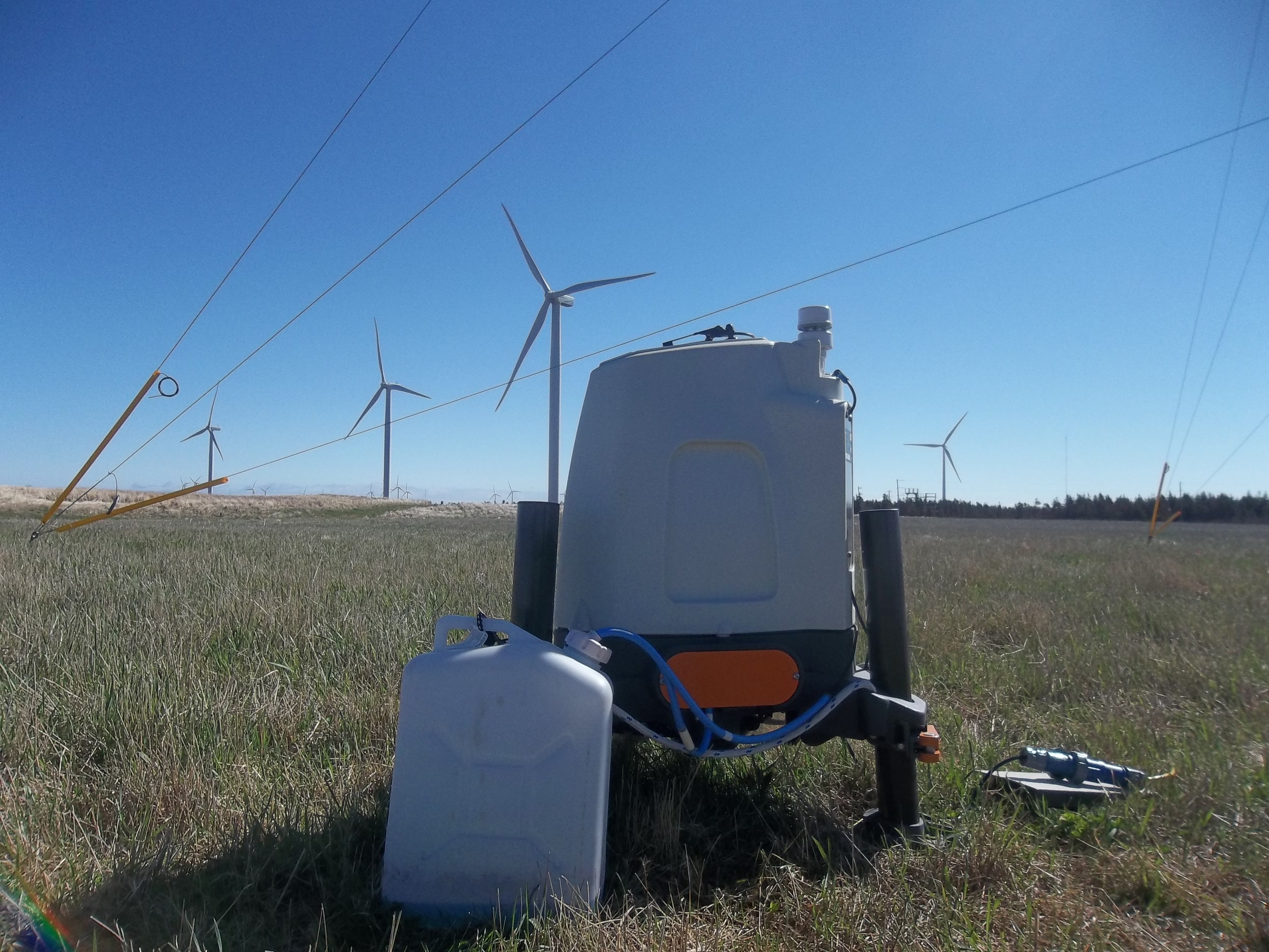 ZephIR profiling lidar near the cliff
 Second ZephIR lidar measuring profiles further inland
 Gill sonic measuring near the cliff edge
 Galion at work scanning wakes
 Discussing the Galion scanning geometry
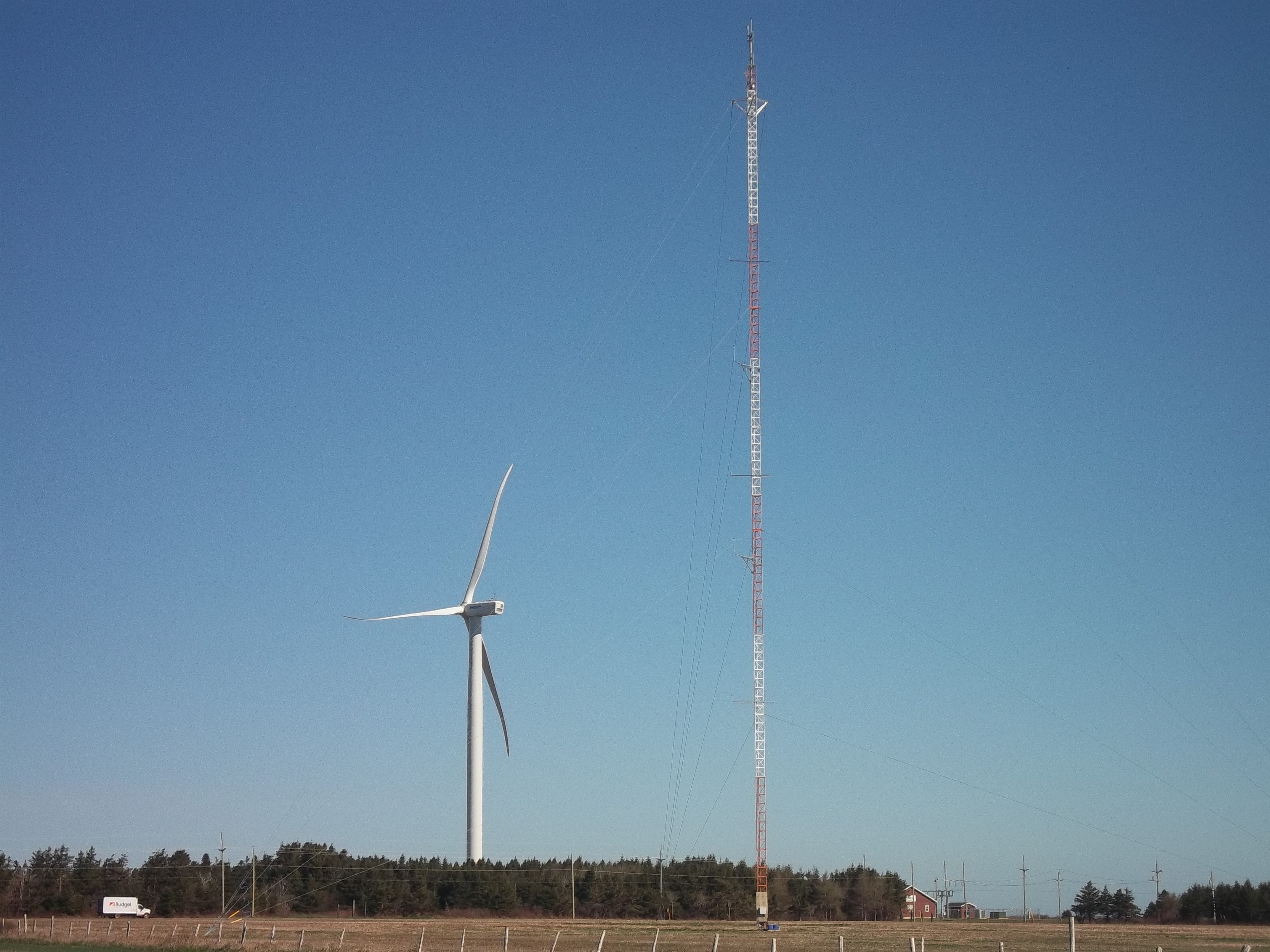 WEICan met mast with additional Cornell sonics
Data
The dataset for flow perpendicular to the coastline is available for download here (see details of the data format and the flow conditions in Barthelmie, R.J., Doubrawa, P. Wang, H., Giroux, G., Pryor, S.C. 2016: Effects of an escarpment on flow parameters of relevance to wind turbines, Wind Energy, 19, 2271-2286). The data set that pertains to the scanning doppler lidar data used in Wang et al. AMT is available here